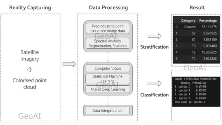
Vegetation mapping is an essential tool for understanding and managing forests. It allows researchers and environmental agencies to monitor forest health, biodiversity, and environmental changes. Traditional forest monitoring methods rely … Continue reading Vegetation Mapping: Revolutionizing Forest Monitoring with High-Resolution Satellite Imagery and LiDAR
0 Comments
