Ultra-Realistic 3D Digital Twin Model Generation
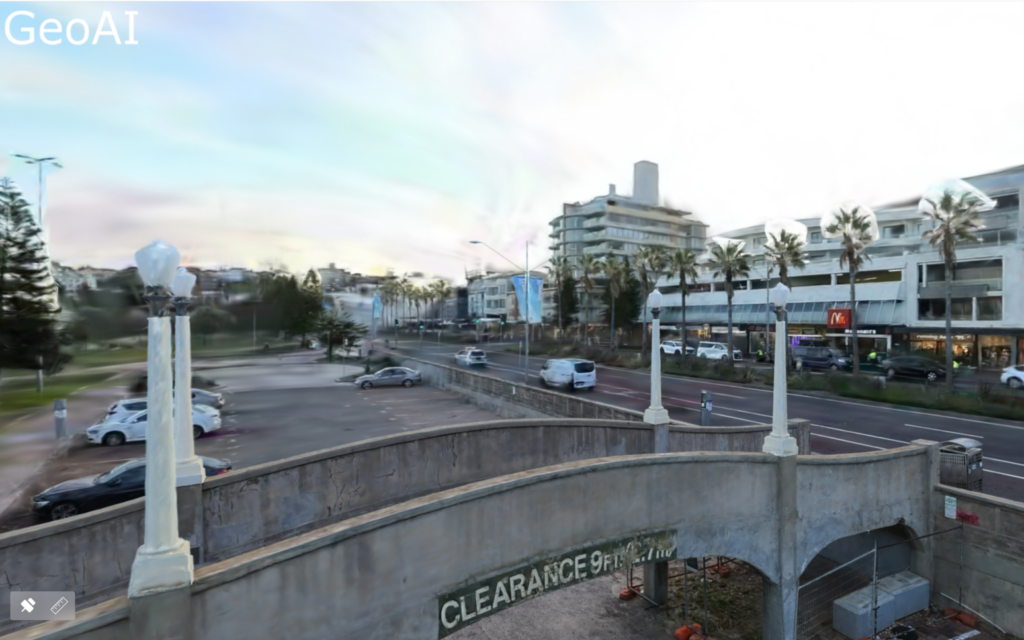
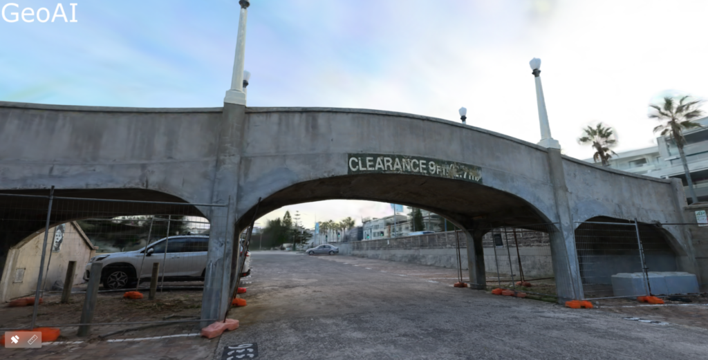
GeoAI presents an Advanced technology to revolutionize the creation of 3D digital twin models, offering unprecedented detail and immersive experiences. By employing a sophisticated fusion of the Multi-SLAM (Simultaneous Localization and Mapping) algorithm and 3D Gaussian Splatting (3DGS) technology, our platform generates intricate 3D digital models with real-time efficiency. These models, which have centimeter-level precision, are ideal for on-site measurement and annotation, thanks to seamless integration with GeoAI Viewing platform.
3D Digital Twin Reconstruction Steps
Step 1: Capture the scene with spatial camera
The process begins with scene capture using spatial cameras equipped with multi-SLAM sensors, capable of capturing indoor and outdoor environments, even in challenging conditions like low light or sparse textures.
Step 2: Automated model generation
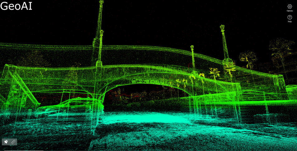
Through AI-powered spatial computing, detailed 3D models are automatically generated, comprising point clouds, panoramic, and mesh models. Utilizing 3D Gaussian Splatting techniques, captured data is stitched together to form a cohesive 3D reconstruction. We use AI-powered dynamic object removal algorithms to remove unwanted objects from the scene to reconstruct the most detailed digital twins.
Step 3: Multiplatform application
Our platform offers multiplatform compatibility, optimizing file sizes by up to 90% compared to other open-source formats, thus facilitating lightweight applications across various platforms including cloud, edge, and mobile. Real-time rendering enhances immersive experiences, with support for avatars and spatial computing equipment like VR viewers. The versatility of our models extends to multiple operating systems, including Android, iOS, Windows, and Mac.
3D Digital Twin Features
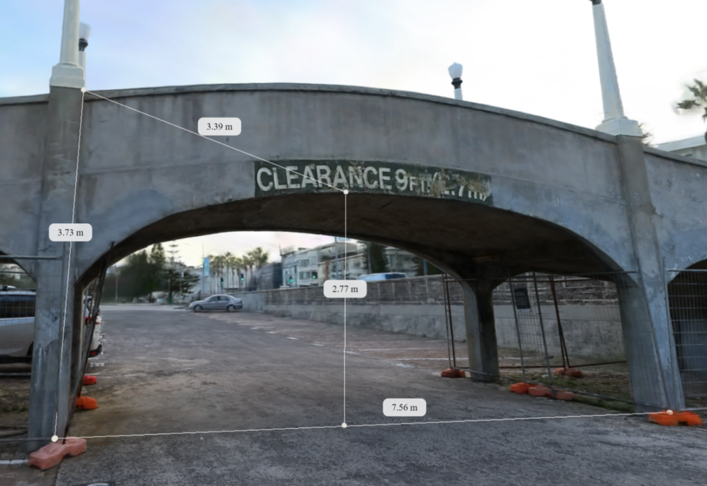
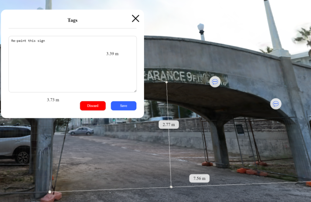
Accurately measure your space
Our platform enables precise measurement and annotation of assets, saving time and eliminating the need for manual site visits. Whether in the construction or operational phase, users can remotely measure and assess properties. For real estate business, the customer can easily check our property and measure whether the size is suitable for their need or not without even steps into the location. It eliminates the need for customers to take manual measurements in Showcase.
Annotation features
Annotation features enable seamless collaborative discussions and meticulous quality control within the 3D model environment. By incorporating measurements, tags, and notes directly into the model, stakeholders can engage in thorough reviews and discussions without the need for extensive paper-based documentation. Additionally, annotations serve as valuable reference points for future iterations and decision-making processes, ensuring clarity and accuracy throughout the project lifecycle.
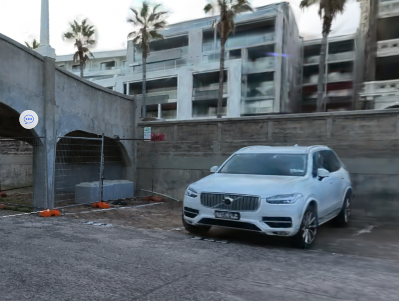
AI-powered dynamic object removal
Dynamic object removal algorithms powered by AI ensure that unwanted elements such as people and plate numbers. We can seamlessly remove those element, resulting in highly detailed digital twins. It not only enhances privacy in the digital twin, but also creates a cleaner customer touring experience.
Make decisions faster with collaboration
The seamless sharing of models among stakeholders accelerates decision-making processes by fostering collaborative discussions on crucial aspects such as compliance, reworks, and change orders. With accurate 3D representations readily available, teams can efficiently evaluate proposed changes and ensure alignment with project requirements. This collaborative approach not only expedites decision-making but also enhances overall project efficiency and reduces the likelihood of errors or misunderstandings. Furthermore, stakeholders can easily reference the shared models to maintain continuity and transparency throughout the project life cycle.
Design Comparison
We have the capability to load design models for easy comparison with the actual digital twin model. This feature empowers stakeholders to effortlessly assess the alignment between initial design concepts and real-world implementation, facilitating more informed decision-making processes. By providing a side-by-side comparison of the design model and the digital twin, users can identify discrepancies, validate design assumptions, and iteratively refine project plans.
Access and share digital twin data
With 24/7 access to digital twin data, teams can collaborate from any location, ensuring that no one is left behind. This accessibility empowers stakeholders to stay connected and informed, regardless of geographical constraints or time zones. By eliminating barriers to collaboration, teams can efficiently coordinate efforts, share insights, and address challenges in real-time.
Immersive Experience Interaction
By combining spatial computing devices and VR viewer, we can provide avatars within your 3D scene. It enhances the immersive experience interaction to support the advancement of project visualization and stakeholder engagement. By embodying avatars, users can interact with elements within the scene, gaining a deeper understanding for the project’s scale, design, and complex spatial relationships. Additionally, this immersive experience fosters greater stakeholder engagement by offering a compelling and interactive platform for communication and collaboration.
Experience yourself into our platform by click on the link below.
Category List
- 3D Point Cloud
- Artificial Intelligence
- Asset Management
- Digital Twin
- Featured
- Hardware
- Knowledge Graph
- LiDAR
- News
- Site Monitoring
- Vegetation Monitoring
- Virtual Reality
Recent Post
- Scan-to-BIM Workflow Explained: From LiDAR Point Cloud to BIM Model
- As-Built Drawing Survey Sydney: LiDAR Verification for Construction Projects
- Digital Twin for Construction Projects – How LiDAR Powers Real-Time Site Models
- Road Asset Management Sydney
- Pavement Condition Survey: AI-Powered Road Assessment for Local Councils