About GeoAI
Welcome to GeoAI, your premier destination for cutting-edge Geospatial Artificial Intelligence solutions. Based in Australia, we specialize in harnessing the power of AI to revolutionize the field of geospatial analysis. At GeoAI, we combine expertise in both artificial intelligence and geospatial sciences to provide innovative solutions that address complex challenges. Our team is dedicated to pushing the boundaries of technology, utilizing advanced algorithms and machine learning techniques to extract valuable insights from geospatial data taken from laser scanner, satellites, large scale imagery, and UAV (drones). Whether you’re in need of predictive modeling, spatial analytics, or custom AI solutions GeoAI is here to deliver unparalleled results. Join us on the forefront of innovation and discover the limitless possibilities of GeoAI.
We are pleased to announce that GeoAI has joined the Resilient and Intelligent Infrastructure System (RIIS) Hub. RIIS is a research and innovation hub supported by both industry and the Australian Research Council (ARC), focusing on smart infrastructure. Through collaboration with industry, government, and the community, RIIS aims to devise and apply evidence-based policies and comprehensive solutions to address the present and future challenges confronting Australia’s infrastructure. GeoAI is currently collaborating with researchers from the University of New South Wales (UNSW) to create an artificial intelligence-driven geospatial solution tailored for various practical applications. GeoAI takes pride in contributing to this research hub. We ensure that all outcomes are underpinned by rigorous research methodologies.
Vision
Our vision is a world where data-driven insights seamlessly integrate with the geographic context. We envision a future where decision-makers can harness the power of Geospatial and AI to make informed choices. It will not only benefit their organizations but also contribute to the well-being of communities and the environment.
Mission
Our mission is to be at the forefront of the GeoAI revolution. We dedicate our self to develop innovative solutions that harness the synergy of geospatial data and Artificial Intelligence algorithms. By providing actionable insights, we empower our clients to optimize operations, drive growth, and make decisions that positively impact the world.
GeoAI Services
GeoAI offers diverse solutions to manage spatial management of your project. Our services includes:
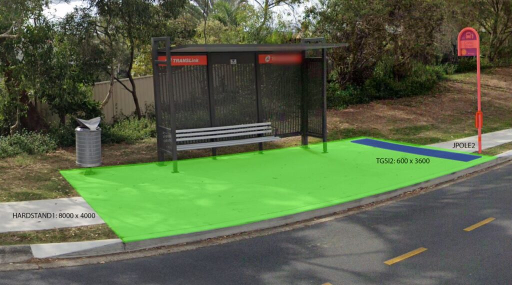
- Development of Digital Twin
- Asset Management
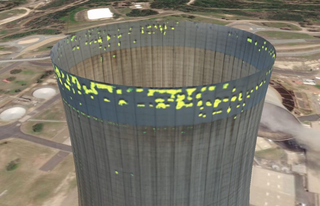
- Constrution Site Monitoring
- Virtual Reality
- Vegetation Monitoring
- Artificial Intelligence
- Knowledge Graph
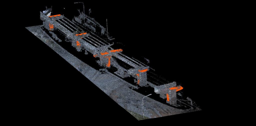
Our extensive range of services is supported by cutting-edge equipment and reality capture techniques. We employ advanced laser scanning and LiDAR technology, which can be mounted on UAVs/drone, mobile platforms, and handheld devices, to obtain precise 3D data. Our high-quality 360-degree cameras further enhance our capabilities by capturing detailed images, videos, and panoramic views. We process the data by using artificial intelligence and knowledge graph methodologies to enable comprehensive data analytics and decision-making. Our proficiency in 3D laser scanning, 3D modeling, monitoring, aerial surveying, and data analytics ensures that we provide accurate and actionable insights, faithfully replicating the real world.

Why Choose GeoAI?

At GeoAI , we are passionate about harnessing the power of Artificial Intelligence with spatial data to revolutionize the way businesses operate. We believe that GeoAI has the potential to unlock unprecedented opportunities for efficiency, sustainability, and growth across various industries.
Driven by this belief, we have assembled a team of experts with deep expertise in GeoAI technologies, data analysis, and project management. Our commitment lies in actively developing innovative solutions that tackle real-world challenges and deliver tangible results for our clients.
Join us on this exciting journey and let’s unlock the future together.