Digital Twin
Transform your Asset into Digital Twin Model
Digital Twin is a digital model of a real-world machine, process, or environment. It has capability to mirroring the physical object behavior and characteristics.
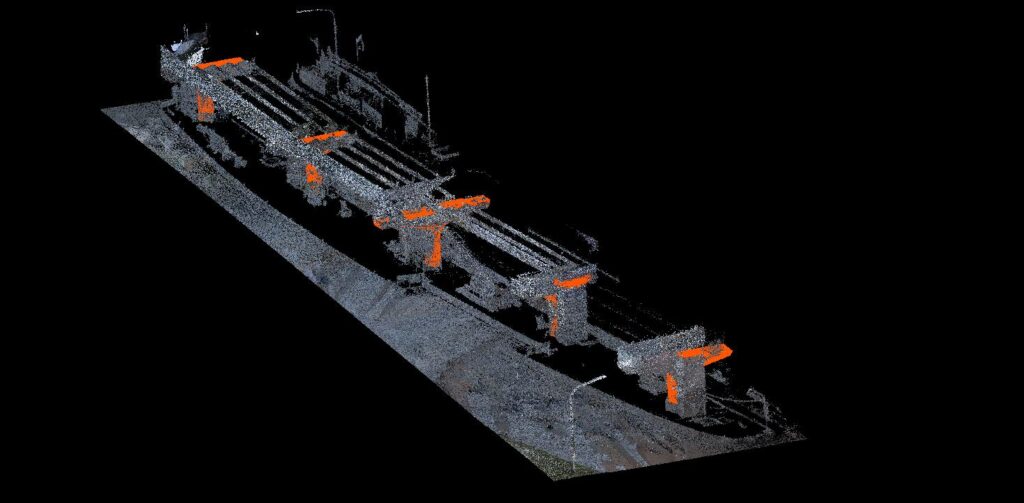
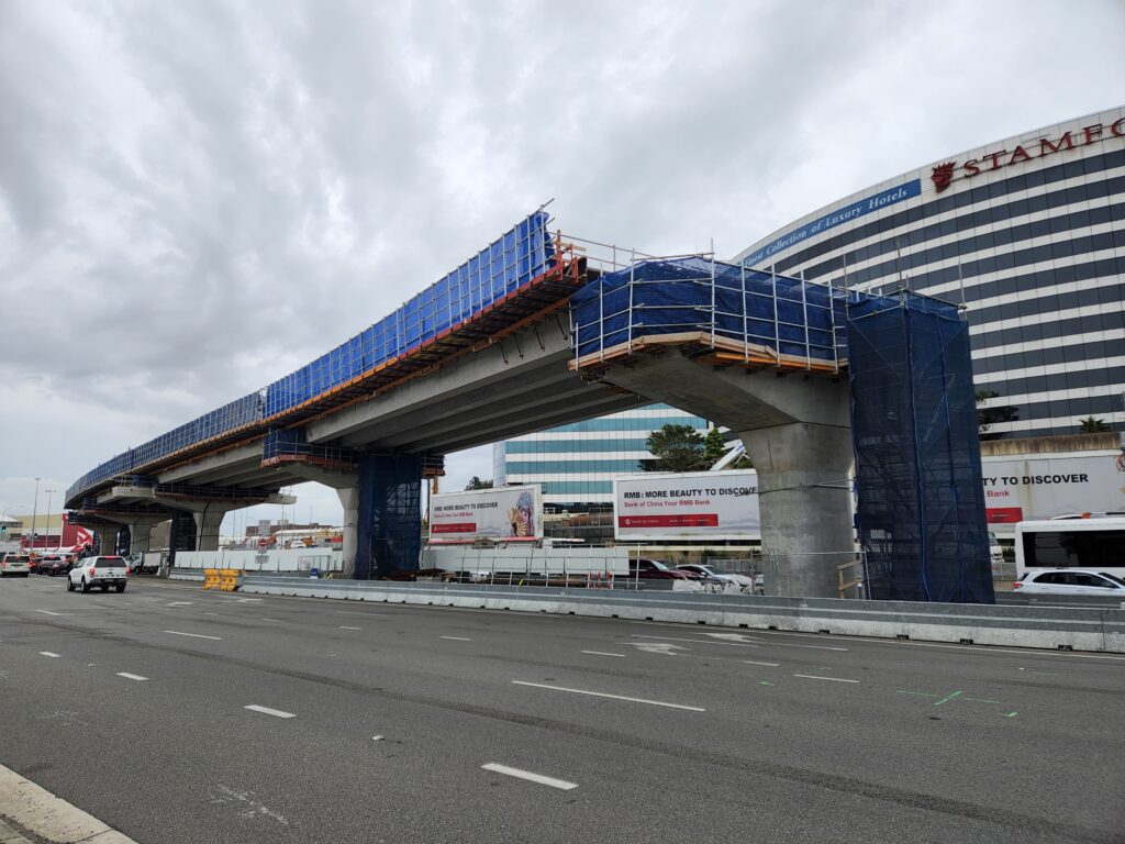
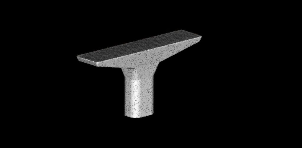
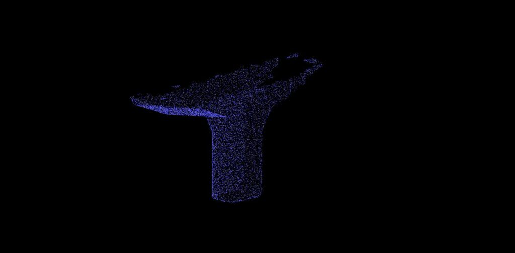
Transform your assets into immersive digital twin models by harnessing a range of cutting-edge technologies including aerial imagery, laser scanning, and advanced data capture methods. This multifaceted approach enables the creation of highly detailed and accurate Digital Twin (DT). It provides a comprehensive and interactive representation of your physical assets.
- Highly Detailed 3D Model: DT offer an incredibly detailed and accurate 3D model of the physical asset or project.
- Historical Data Tracking: DT retains historical data, allowing for a retrospective analysis of the construction process.
- Interactive Elements: The DT experience is interactive. It allowing users to virtually explore and interact with the site. This includes the ability to navigate through the 3D model, zoom in on specific areas, and access detailed information about individual components, fostering a more engaging and immersive experience.
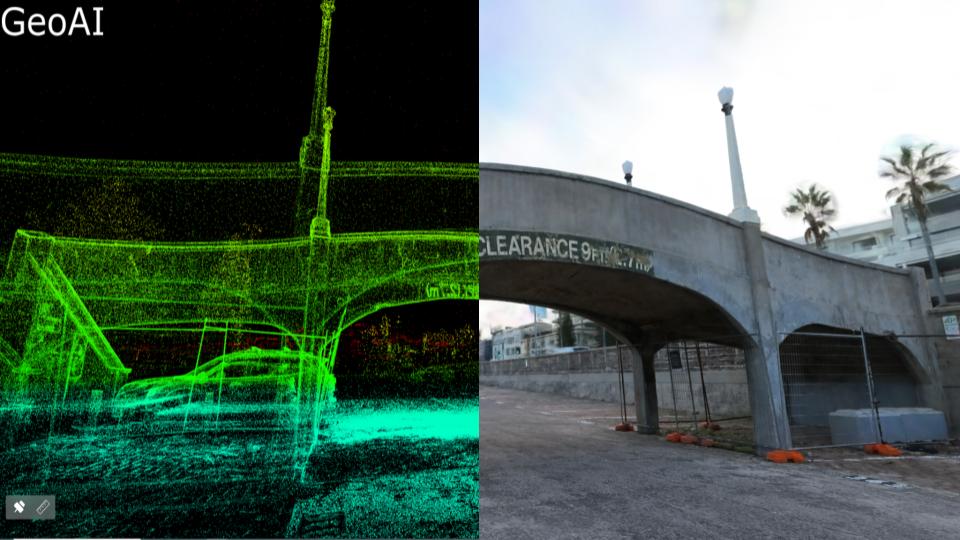
New Digital Twin Platform: Explore 2D and 3D Model with Measurement Features
We have unveiled our latest innovation: the Digital Twin GeoAI Viewer. This cutting-edge tool is set to revolutionize the way we do urban planning, and monitor your project.
One of the standout features of the new GeoAI Viewer is its high degree of customization. GeoAI understands that different industries and projects have unique requirements, so the viewer can be tailored to meet specific customer needs. Whether for urban planning, construction, environmental monitoring, or any other application, users can customize the viewer to visualize and analyze the data most relevant to their goals. The features included in the new portal is 360 panorama viewer, 2D and 3D model, and measurement (distance, area, volume).
Ultra-Realistic 3D Digital Twin
GeoAI presents an Advanced technology to create 3D digital twin models. By employing a sophisticated fusion of the Multi-SLAM (Simultaneous Localization and Mapping) algorithm and 3D Gaussian Splatting (3DGS) technology, our platform generates intricate 3D digital models with real-time efficiency. These models, which have centimeter-level precision, are ideal for on-site measurement and annotation, thanks to seamless integration with GeoAI Viewing platform.
Digital Twin for Asset Management
Digital twins are revolutionizing asset inspection by creating virtual replicas of physical assets like buildings, factories, or wind turbines. These digital models integrate real-time sensor data, allowing inspectors to remotely monitor the health of the asset, identify potential problems before they occur, and plan maintenance interventions for maximum efficiency and cost savings. The digital twin will be updated based on actual physical project condition.
Due to the cooling tower’s significant height of 120 meters, traditional method for capturing a 3D model proved impractical. To overcome this challenge, GeoAI created a digital twin using drone-based LiDAR technology. This advanced technique provided highly detailed 3D data. The data will be used to assess the extent of deterioration and develop a comprehensive maintenance plan for the tower.
Digital Twin Technology to Analyze Your Data in Real-Time
Apply the power of real-time data analysis to gain immediate and actionable insights into your business operations. Analyzing your data in real-time allows for the rapid identification of patterns, trends, and anomalies. As a result, it will enable a prompt decision-making for the stakeholders.
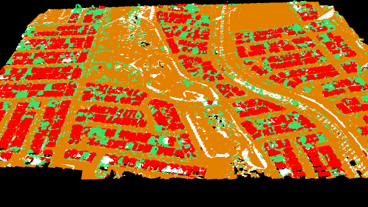
One of a digital twins example is building footprint in a city area. It is a virtual replica of physical building, providing actual data and insights for effective urban planning, transportation planning, and sustainability initiatives.
Easily Access and Share your Digital Model
Our user-friendly platform ensures that stakeholders can easily retrieve the digital model of your assets. Whether you’re on-site or in the boardroom, the accessibility of the digital twinning technology empowers teams to make decisions based on real-time information.
Share insights, gather feedback, and enhance communication with a simple and intuitive interface, ensuring that your digital model becomes a central hub for effective collaboration across all stages of your project or asset management.
Digital Twin Dashboards: Command Central for Your Construction Site
Say goodbye to information silos and scattered spreadsheets. The future of construction is here, and it’s called the digital twin dashboard. This centralized hub puts all your project data in one place, giving you a real-time, 3D view of everything from materials and equipment to worker progress and safety hazards.
Imagine a dynamic map of your construction site, overlaid with real-time data feeds from sensors, cameras, and drones. You can see exactly where each piece of equipment is located, track worker progress, and monitor environmental conditions like temperature and humidity. The dashboard can also be used to identify potential problems before they arise, such as delays, safety risks, or quality control issues.
DT dashboards are still in their early stages, but they have the potential to revolutionize the construction industry. By providing a real-time, data-driven view of your projects, they can help you build better, faster, and cheaper. If you’re looking for a way to gain a competitive edge in the construction industry, investing in a digital twin dashboard is a smart move.
Article
DT Technology for Architecture, Engineering, and Construction Industry