Aerial Mapping Technologies for War Casualties Identification
Project Background: The Buna War Graves Project sought to document and map the war graves located in the Buna region, with the aim of preserving their historical significance and ensuring proper maintenance. The project involved identifying and recording the locations of war graves, as well as gathering information about the soldiers buried there, such as their names, ranks, and military units. GeoAI introduce the utilization of aerial mapping using UAV LiDAR to solve this problem.
Challenges: Remote Area Location for Mapping
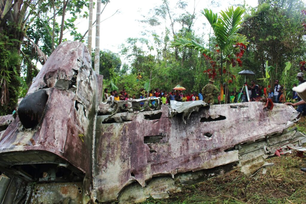
The project faced several challenges, including the vast number of war graves spread across the Buna region and the lack of accurate records. The graves were often located in remote and inaccessible areas, making manual documentation and mapping a time-consuming and challenging task. Additionally, the limited historical information available posed difficulties in accurately identifying and honouring the fallen soldiers.
GeoAI Solution: Drone-based Photogrammetry and LiDAR Scanning to Produce Aerial Map
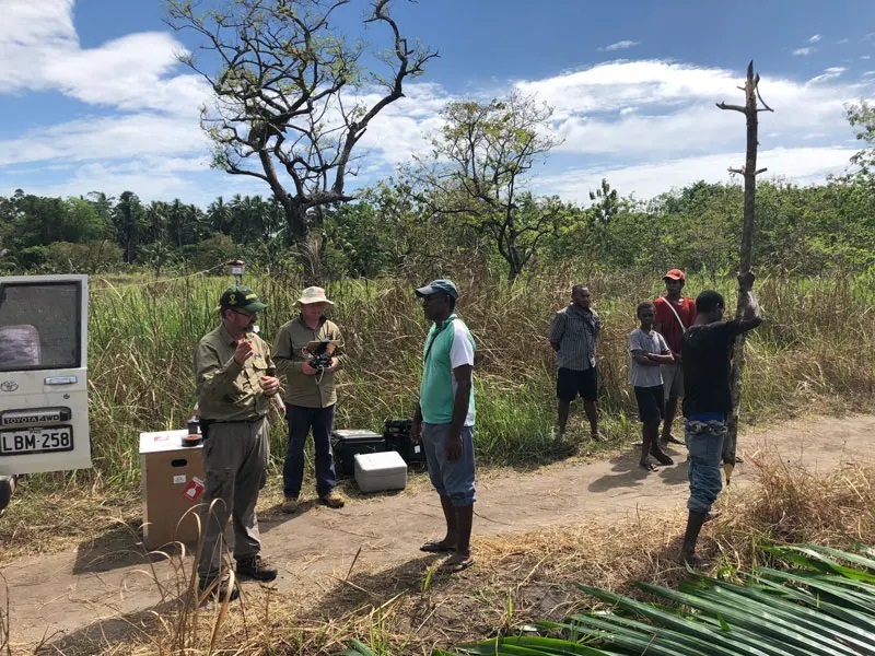
To address these challenges, the Buna War Graves Project partnered withGeoAI, a leading geospatial data company. GeoAI proposed a comprehensive solution that leveraged advanced surveying technologies and techniques to accurately document and map the war graves.
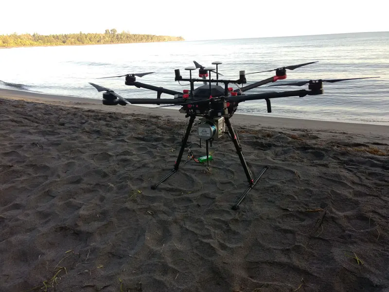
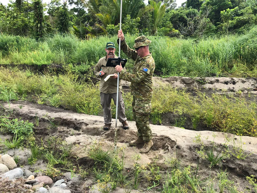
GeoAI utilized drone-based photogrammetry and LiDAR scanning to capture high-resolution aerial imagery and 3D point cloud data. This data was then processed to generate accurate terrain models and orthophotos, revealing the locations of the war graves in great detail. GeoAI also collaborated with local historians and experts to gather additional historical information and cross-reference it with the collected data.
The combination of aerial surveying technologies, historical research, and data analysis provided by GeoAI allowed for a comprehensive mapping of the war graves. The resulting dataset not only documented the locations of the graves but also provided valuable information about the soldiers buried there, enhancing the historical significance and preservation efforts.
Category List
- 3D Point Cloud
- Artificial Intelligence
- Asset Management
- Digital Twin
- Featured
- Hardware
- Knowledge Graph
- LiDAR
- News
- Site Monitoring
- Vegetation Monitoring
- Virtual Reality
Recent Post
- Scan-to-BIM Workflow Explained: From LiDAR Point Cloud to BIM Model
- As-Built Drawing Survey Sydney: LiDAR Verification for Construction Projects
- Digital Twin for Construction Projects – How LiDAR Powers Real-Time Site Models
- Road Asset Management Sydney
- Pavement Condition Survey: AI-Powered Road Assessment for Local Councils
Conclusion
Through the partnership with GeoAI, this Project successfully overcame the challenges associated with documenting and mapping the war graves. GeoAI’s innovative surveying solutions, including drone-based photogrammetry and LiDAR scanning, enabled the accurate and efficient identification of war grave locations. The collaboration between GeoAI and local historians ensured that the collected data was supplemented with historical information. It further enhancing the significance of the project. Overall, the project served as a successful proof of concept. It can demonstrate the effectiveness of advanced surveying technologies in preserving the war graves of fallen soldiers.