GeoAI Panoramic Aerial Viewer
Introducing the GeoAI Panoramic Aerial Viewer: A New Perspective on Construction Projects
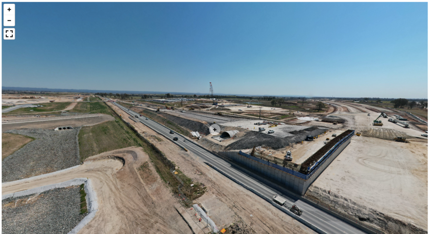
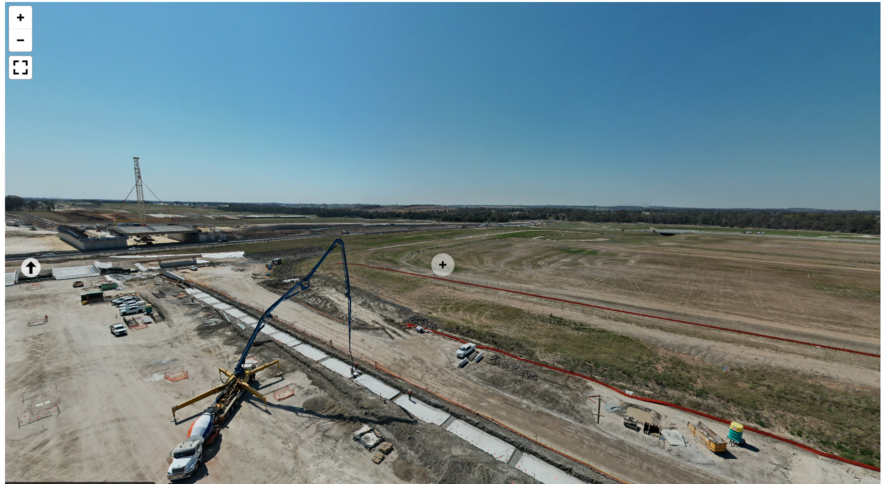
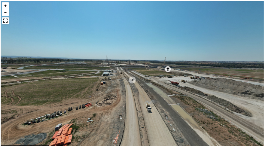
We are thrilled to unveil the latest example of our cutting-edge viewer technology: the GeoAI Panoramic Aerial Viewer. This innovative tool leverages advanced aerial imaging to provide a comprehensive view of construction projects, ensuring no detail goes unnoticed.
Capturing the Bigger Picture
Our GeoAI Panorama Viewer optimize the power of high-resolution cameras mounted on UAVs (Unmanned Aerial Vehicles) to capture detailed, panoramic images of construction sites. The UAV will fly around your site project, operated by our experienced drone pilot to ensure an effective data capturing. This technology allows us to provide a full, immersive picture of the entire project area. It offers insights that are simply not possible with traditional ground-based photography.
High-Resolution Imaging
We mount a high-resolution cameras in UAVs to capture aerial images from our site project. We want to capture every aspect of the construction in stunning detail. From the smallest structural elements to the overall site layout, our GeoAI Panoramic Aerial Viewer delivers clear, precise images that can be used for a variety of applications. We can use it for progress monitoring, resource management, quality control, and site management.
Comprehensive Project Monitoring
With the GeoAI Panorama Aerial Viewer, stakeholders can monitor the progress of construction projects in real time. The panoramic images provide a holistic view of the site. We can view the project from both aerial and ground perspectives. We can move, zoom in, zoom out, and rotate the images to the desired angle. This makes it easier to see the most up-to-date condition of the construction project without needing to visit the site in person. It allows project managers, engineers, and clients to track developments, identify potential issues, and make informed decisions quickly and efficiently.
Enhanced Site Analysis
Our viewer is more than just a visual tool. It is an analytical powerhouse. We can extract valuable data on site such as material inventory, equipment, site mapping, and construction progress by integrating Artificial Intelligence technology. Project manager can track resources by using image-based object detection. In terms of project update, we can track the construction progress by comparing actual 3D point cloud data with the design plan. This data-driven approach enhances the accuracy and reliability of site assessments, leading to better project outcomes.
Accessibility and Convenience
We design the GeoAI Aerial Viewer to be user-friendly and accessible from any device with an internet connection. This means that all stakeholders can easily access up-to-date images and data from the construction site, whether they are in the office, on-site, or even halfway around the world. Effective project progress visualization can also enhance engagement with stakeholders and increase user satisfaction. By the usage of GeoAI viewer, we expect that it can give benefit to the company by improving trust from users, the government, and the community.
Transforming Construction Management
The introduction of the GeoAI Panoramic Aerial Viewer represents a significant advancement in construction management. Our platform provide a comprehensive, detailed, and real-time view of construction sites. This tool empowers project teams to work more efficiently and reduce errors. As a result, it ensures that teams can complete projects on time and within budget.
Experience the Future of Construction Monitoring
We invite you to explore the GeoAI Panoramic Aerial Viewer and see firsthand how this innovative tool can transform your approach to construction project management. With our state-of-the-art imaging technology and powerful analytical capabilities, you can gain unparalleled insights into your construction projects, leading to better decisions and better results.
For more information or to schedule a demonstration, please contact us today. Experience the future of construction monitoring with the GeoAI Panoramic Aerial Viewer!
Category List
- 3D Point Cloud
- Artificial Intelligence
- Asset Management
- Digital Twin
- Featured
- Hardware
- Knowledge Graph
- LiDAR
- News
- Site Monitoring
- Vegetation Monitoring
- Virtual Reality
Recent Post
- Digital Twin Integration for Road Networks Using LiDAR and AI
- Pavement Crack Detection using AI and LiDAR
- Pavement Defect Detection with GeoAI: Harnessing Laser Scanners and Profilers
- Asset Inventory Mapping with GeoAI: Complete Road Asset Capture Using Laser Scanning and Profiling
- Mobile Laser Scanner and Laser Profiler: Dual Approach to Road Surface Condition Surveys