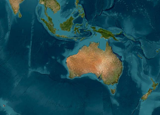
High Resolution Satellite Images: Where to find them?
In today’s data-driven world, high resolution satellite images have become an indispensable tool for industries, governments, and researchers alike. From urban planning to environmental monitoring, these images provide a bird’s-eye view of our planet. It offers insights that were once unimaginable. But what exactly are satellite images, where can you find high-resolution ones, and how can they be utilized, especially in the emerging field of GeoAI? Let’s dive in.
What Are Satellite Images?
Satellite images are photographs of the Earth or other planets captured by imaging satellites orbiting the planet. These images are created using sensors that detect and record reflected or emitted energy from the Earth’s surface. Depending on the satellite’s capabilities, these images can range from low to ultra-high resolution, with the latter providing intricate details of the Earth’s surface.
High-resolution satellite images offer a level of detail that allows users to identify objects as small as cars, trees, or even individual buildings. This makes them invaluable for a wide range of applications, from disaster management to urban development.
High-resolution satellite imagery refers to images captured with a small ground sample distance (GSD), meaning each pixel represents a small area on the Earth’s surface. The resolution is typically measured in meters per pixel (m/pixel) or centimeters per pixel (cm/pixel).
For example:
- 30m per pixel (Landsat) means each pixel represents a 30m × 30m area on the ground.
- 50cm per pixel (Maxar’s WorldView-3) means each pixel represents a 50cm × 50cm area on the ground.
Types of Satellite Image Resolutions
- Spatial Resolution (Ground Sampling Distance – GSD)
- Defines the smallest object that can be detected in an image.
- Categories:
- Low Resolution (>30m per pixel) – MODIS, AVHRR
- Medium Resolution (10m–30m per pixel) – Landsat, Sentinel-2
- High Resolution (1m–10m per pixel) – SPOT, RapidEye
- Very High Resolution (<1m per pixel) – Maxar (WorldView, GeoEye), Airbus Pleiades
- Spectral Resolution
- Refers to the number of spectral bands a satellite can capture.
- Examples:
- Panchromatic (single-band, grayscale) – High-resolution details
- Multispectral (RGB + NIR, 3–10 bands) – Sentinel-2, Landsat
- Hyperspectral (hundreds of bands) – Hyperion, EnMAP
- Temporal Resolution
- The frequency of image capture over the same area.
- Examples:
- Daily or near-daily – MODIS, PlanetScope
- Every few days – Sentinel-2 (5 days), Landsat-8 (16 days)
- On-demand tasking – Maxar, Airbus
- Radiometric Resolution
- The sensitivity of a satellite sensor to detect differences in light intensity.
- Measured in bit-depth (e.g., 8-bit, 12-bit, 16-bit).
- Higher bit-depth allows detecting finer variations in surface reflectance.
Where to Find High Res Satellite Images?
With the growing demand for satellite imagery, several platforms and providers offer access to high-resolution satellite images. Here are some of the most popular sources:
- Google Earth Engine: A powerful platform that provides access to a vast archive of satellite imagery, including high-resolution images from sources like Landsat and Sentinel.
- NASA’s Earth Observing System (EOS): Offers free access to satellite data, including high-resolution images, for research and educational purposes.
- Commercial Providers: Companies like Maxar Technologies, Planet Labs, and Airbus Defence and Space offer premium high-resolution satellite images for commercial use.
- USGS Earth Explorer: These platforms provide free and open-access satellite imagery, including high-resolution options, for various applications.
Free & Open Satellite Imagery Sources
| Satellite | Resolution | Where to Access |
|---|---|---|
| MODIS (Terra/Aqua) | 250m–1000m | NASA Worldview, USGS Earth Explorer, Google Earth Engine |
| Landsat-8/9 | 30m (Multispectral), 15m (Panchromatic) | USGS Earth Explorer, Google Earth Engine |
| Sentinel-2 | 10m (Multispectral), 20m (SWIR) | ESA Copernicus Open Hub, Google Earth Engine, Sentinel EO Browser |
Steps to Download (for Landsat, MODIS, Sentinel):
- Register for an account on USGS Earth Explorer or Copernicus Open Hub.
- Define your area of interest (AOI) using the map interface.
- Select the satellite dataset you need.
- Choose the best date and cloud coverage.
- Download the imagery (GeoTIFF format for GIS processing).
Commercial High-Resolution Satellite Imagery
| Satellite | Resolution | Where to Access |
|---|---|---|
| SPOT-6/7 | 1.5m | Airbus OneAtlas |
| RapidEye | 5m | Planet Labs |
| PlanetScope | 3m | Planet Labs |
| WorldView (Maxar) | 31cm–50cm | Maxar |
| Pleiades-1 | 50cm | Airbus OneAtlas |
How to Access Paid Imagery (SPOT, RapidEye, WorldView, etc.):
- Visit the provider’s website (e.g., Maxar, Planet, Airbus).
- Request a trial account or free preview (some providers offer limited previews).
- Define your area of interest (AOI) and specify resolution/timeframe.
- Get a price quote and purchase images if needed.
- Download images in GeoTIFF format for GIS processing.
Cloud-Based Analysis Platforms (No Download Required)
If you don’t want to download large files, you can use cloud-based GIS platforms:
- Google Earth Engine – Analyzes Landsat, MODIS, and Sentinel data without downloading.
- Sentinel EO Browser – View Sentinel data in a web interface.
- NASA Worldview – Browse MODIS, VIIRS, and Landsat imagery interactively.
What Can We Do with Satellite Images? Exploring the GeoAI Revolution
Satellite images are more than just pictures. They are a treasure trove of data waiting to be analyzed. With advancements in Geographic Artificial Intelligence (GeoAI), the potential applications of high-resolution satellite imagery have expanded exponentially.
Once you’ve downloaded the images, you can use:
- QGIS or ArcGIS – To visualize and analyze geospatial data.
- Google Earth Engine (GEE) – For cloud-based processing.
- Python (Rasterio, GDAL, OpenCV) – To automate satellite image analysis.
Here’s how they are being used:
1. Land Cover and Land Use Analysis
High-resolution satellite images enable detailed mapping of land cover (natural and artificial features on the Earth’s surface) and land use (how humans utilize the land). This is crucial for urban planning, agriculture, and environmental conservation. For example:
- Identifying deforestation patterns.
- Monitoring urban sprawl and its impact on ecosystems.
- Assessing agricultural land for crop health and yield prediction.
2. Disaster Management and Response
Satellite imagery plays a critical role in disaster management by providing real-time data on natural disasters such as floods, earthquakes, and wildfires. High-resolution images help:
- Assess damage to infrastructure.
- Plan evacuation routes.
- Monitor recovery efforts.
3. Environmental Monitoring
From tracking glacier melt to monitoring coastal erosion, high-resolution satellite images provide invaluable data for environmental scientists. They help:
- Detect changes in ecosystems over time.
- Monitor pollution levels in water bodies.
- Track wildlife habitats and migration patterns.
4. Infrastructure Development
Governments and private companies use satellite imagery to plan and monitor infrastructure projects. High-resolution images help:
- Identify suitable locations for construction.
- Monitor the progress of large-scale projects like highways, airports, and dams.
- Detect unauthorized constructions or land use changes.
5. GeoAI and Machine Learning Applications
GeoAI combines geospatial data with artificial intelligence to extract meaningful insights. High-resolution satellite images are a key input for GeoAI models, enabling:
- Automated detection of objects like buildings, roads, and vehicles.
- Land cover and land use classification
- Predictive analytics for urban growth and climate change.
- Precision agriculture by analyzing soil health and crop conditions.
The Future of High-Resolution Satellite Images in GeoAI
As technology continues to evolve, the resolution and accuracy of satellite images are improving, opening up new possibilities for GeoAI applications. With the integration of machine learning and big data analytics, high-resolution satellite imagery is transforming how we understand and interact with our planet.
Whether you’re a researcher, a business owner, or a policymaker, leveraging high-resolution satellite images can provide you with the insights needed to make informed decisions. From monitoring environmental changes to optimizing land use, the possibilities are endless. GeoAI is ready to help you along your journey. Do not hesitate to contact us.
Category List
- 3D Point Cloud
- Artificial Intelligence
- Asset Management
- Digital Twin
- Featured
- Hardware
- Knowledge Graph
- LiDAR
- News
- Site Monitoring
- Vegetation Monitoring
- Virtual Reality
Recent Post
- Pavement Crack Detection using AI and LiDAR
- Pavement Defect Detection with GeoAI: Harnessing Laser Scanners and Profilers
- Asset Inventory Mapping with GeoAI: Complete Road Asset Capture Using Laser Scanning and Profiling
- Mobile Laser Scanner and Laser Profiler: Dual Approach to Road Surface Condition Surveys
- Edge Pavement Detection: Using LiDAR and AI for Road Asset Management