How to Access GeoAI 3D Viewer?
To access GeoAI 3D Viewer there are some steps you need to follow starting from creating profile in our website https://viewer.geoai.au/
1. Contact Us
- Send an email to admin@geoai.au
- In your email, make sure to include: Your full name, email address, and name of the project
- This will allow us to verify your details and begin the account creation process.
- We use a strict user profile creation to ensure the confidentiality of each project we handle.
2. User Verification
Once we receive your email, we will verify your information and eligibility to create a profile on viewer.geoai.au
3. Receive Username and Temporary Password
- After verification, we will send you an email containing your username and a temporary password
- This email will be sent from no-reply@geoai.au. Make sure to check your inbox or spam folder and avoid marking this email as phishing, as it is the legitimate account creation email.

4. Login within 7 Days
- You must log in to your account within 7 days of receiving the invitation email.
- If you do not log in within this period, your temporary password may expire, and you will need to contact us again.
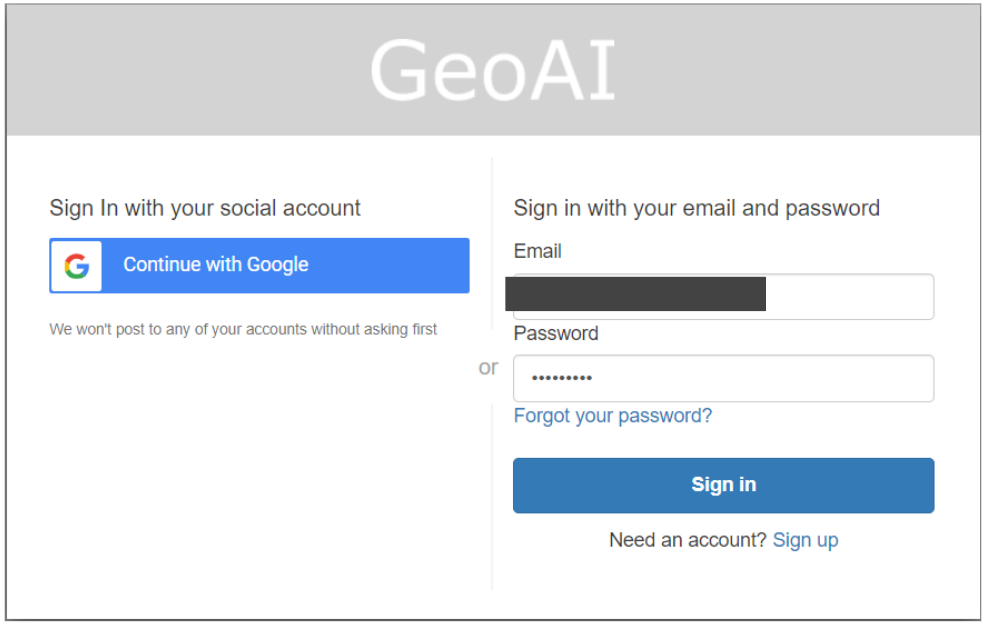
5. Login to Your Account
- Go to the viewer.geoai.au website.
- Enter the username and temporary password provided in the email to log in.
6. Change Your Password
- Once logged in, it is recommended that you change your temporary password to something more secure and personal
- If you want to change your password after logging in, click on the ‘Forgot Your Password’ link on the login page.
- Enter your registered email address, and we will send you a message with instructions to reset your password.
That’s it! Your profile on viewer.geoai.au is now set up and ready to use. Access the viewer and explore different capabilities here.
If you have any issues, please reach out to our support team at admin@geoai.au for further assistance.
Category List
- 3D Point Cloud
- Artificial Intelligence
- Asset Management
- Digital Twin
- Featured
- Hardware
- Knowledge Graph
- LiDAR
- News
- Site Monitoring
- Vegetation Monitoring
- Virtual Reality
Recent Post
- Asset Inventory Mapping with GeoAI: Complete Road Asset Capture Using Laser Scanning and Profiling
- Mobile Laser Scanner and Laser Profiler: Dual Approach to Road Surface Condition Surveys
- Edge Pavement Detection: Using LiDAR and AI for Road Asset Management
- What is Digital Surface Model (DSM)?
- Happy New Year 2026 from GeoAI