Understanding the Impact of Urban Heat Island
Impact of Urban Heat Island is a growing concern in many cities, as urban environments tend to trap more heat than natural landscapes. This phenomenon occurs because heat from the Sun is absorbed by building materials such as bricks, concrete, roads, and parking lots, which then radiate it back into the surrounding air. In some cases, urban surfaces and buildings can be up to 10–20°C warmer than the surrounding air temperature. These materials continue releasing heat even after the air temperature has dropped. As a result, it elevates evening temperatures.
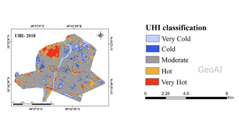
The Urban Heat Island effect impacts urban areas by increasing surface and building temperatures by up to 10–20°C warmer than the surrounding air.
Impact of Urban Heat Island
People’s Health and Wellbeing
The urban heat island effect poses significant health risks, especially for vulnerable populations such as the older people, children, and individuals with pre-existing health conditions. High temperatures increase the risk of heat exhaustion, heatstroke, dehydration, and respiratory issues due to poorer air quality. Prolonged exposure to high urban temperatures also exacerbates cardiovascular diseases and can lead to an increase in heat-related deaths during extreme heat events.
Economic Productivity
The UHI effect reduces economic productivity by affecting worker performance, particularly in outdoor industries such as construction, agriculture, and transportation. Excessive heat exposure leads to increased breaks, reduced efficiency, and higher risks of workplace accidents. Additionally, businesses and households face higher cooling costs due to increased air conditioning use, straining energy grids and raising electricity expenses.
Urban Wildlife and Ecosystems
Higher urban temperatures disrupt local wildlife and ecosystems. The animals is forcing to adapt to rising heat or relocate to cooler areas. Reduced vegetation and overheated water bodies affect biodiversity by altering natural habitats, food availability, and water resources. Certain species may struggle to survive in these harsh conditions, leading to a decline in urban biodiversity and ecological imbalances.
Urban Infrastructure and Services
Prolonged high temperatures accelerate infrastructure deterioration. It leads to road surface damage, rail track expansion, and increased wear and tear on buildings. Heat-related stress can also affect water supply systems, power grids, and public transport networks, resulting in frequent breakdowns and increased maintenance costs. Rising urban temperatures place additional pressure on healthcare services as more people suffer from heat-related illnesses.
Climate Changes impact for UHI
Climate change intensifies the urban heat island effect by increasing overall global temperatures. As the Earth’s climate warms, urban areas experience even higher temperatures due to their dense infrastructure and lack of natural cooling mechanisms. Rising temperatures lead to increased demand for air conditioning, which further contributes to heat emissions and energy consumption, creating a feedback loop that worsens the UHI effect.
Extreme weather patterns caused by climate change, such as prolonged heatwaves and reduced rainfall, further amplify UHI. Drier conditions reduce soil moisture and limit vegetation growth, both of which are critical in cooling urban spaces. Additionally, more frequent and intense heatwaves cause urban areas to remain hotter for extended periods, exacerbating health risks such as heat stress and respiratory problems.
Vegetation and water play a key role in reducing urban heat. They work together to cool surrounding areas. The lower level of vegetation and water in urban areas reduces the natural cooling effect provided by plants. As a result, it makes the cities even hotter. Without adequate greenery, cities become more vulnerable to extreme heat, making sustainable urban planning essential for mitigating climate change’s impact on UHI.
Human Activities impact for UHI
The main source heat for the urban area is sun. However, human activities can exacerbate the increasing of heat in the urban area. From the direct activity, human plays a significant role in generating heat. Transport, industry, and electricity usage all contribute to higher temperatures in urban areas. Vehicles and industrial processes release excess heat, while energy-intensive buildings and air conditioning systems further add to the warming effect. Meanwhile for the indirect activity, the increasing of green house gas emission from deforestation, industrial agriculture (especially fertilizer use), and livestock farming (methane emissions from animals).
How to Mitigate Impact of Urban Heat Island?
To mitigate the urban heat island effect, cities need to adopt sustainable strategies. Reducing greenhouse gas emissions is crucial in addressing overall temperature rise. Increasing vegetation and green spaces can help counteract heat absorption by providing natural cooling effects. Using reflective and heat-resistant building materials can reduce the amount of heat absorbed by urban structures. Incorporating sustainable and water-sensitive design practices, such as green roofs, permeable pavements, and urban shading, can also play a key role in reducing urban temperatures and improving overall livability.
As cities continue to expand, addressing the impact of urban heat islands will be essential for creating more sustainable and comfortable environments. Implementing these strategies can help mitigate heat retention and create urban spaces that are more resilient to rising temperatures.
How GeoAI Enhances UHI Mapping and Decision-Making
GeoAI provides an advanced, automated solution for urban heat island mapping and data-driven decision-making. By using point cloud data and high-resolution images for reality capture, GeoAI enables precise monitoring and analysis of urban heat distribution. Using Remote Sensing-based AI solutions, cities can perform detailed land segmentation, spectral and temporal analysis, environmental studies, and localized strategy development to combat UHI.
Key capabilities of GeoAI for UHI management include:
- Automatic UHI Mapping: AI-driven analysis of remote sensing data to identify and quantify heat-affected zones in urban environments.
- Land Segmentation and Spectral Analysis: Differentiates urban surfaces (e.g., roads, vegetation, water bodies) to assess their contribution to UHI.
- Environmental Study and Localized Strategy: Identifies specific areas where interventions such as increased vegetation, reflective surfaces, or cooling infrastructure can be most effective.
- GIS Data Interpretation: Integrates multiple geospatial data sources to generate actionable insights for urban planners and policymakers.
By providing precise and real-time insights, GeoAI helps cities implement targeted cooling strategies, optimize urban planning, and reduce the long-term impacts of UHI. This AI-powered approach ensures that decision-makers have access to accurate, scalable, and secure data, leading to more effective and sustainable solutions for heat mitigation.
Category List
- 3D Point Cloud
- Artificial Intelligence
- Asset Management
- Digital Twin
- Featured
- Hardware
- Knowledge Graph
- LiDAR
- News
- Site Monitoring
- Vegetation Monitoring
- Virtual Reality
Recent Post
- Smart City Infrastructure Monitoring for Civil Engineers Using LiDAR and AI
- Digital Twin Integration for Road Networks Using LiDAR and AI
- Pavement Crack Detection using AI and LiDAR
- Pavement Defect Detection with GeoAI: Harnessing Laser Scanners and Profilers
- Asset Inventory Mapping with GeoAI: Complete Road Asset Capture Using Laser Scanning and Profiling