LiDAR for Vegetation Analysis
Laser Scanning for a Greener Future
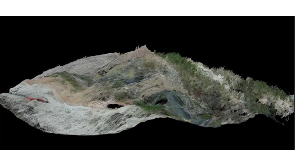
Aerial LiDAR can be a high-tech botanist’s assistant. By using laser scanning method, it utilizes lasers mounted on airplanes or drones to create incredibly detailed 3D scans of the landscape. These scans penetrate vegetation canopies, revealing the structure and distribution of plants below. Here’s how LiDAR empowers vegetation analysis:
- Rapid Data Acquisition: LiDAR surveys vast areas in a single flight, significantly reducing the time and resources required for traditional field studies. It has high efficiency by capturing data around 2 km square in a single flight.
- Unprecedented Detail: LiDAR sensor captures around 240.000 points per second. As a result, the height, density, and even crown shapes of vegetation mapping can be produced. This data provides a wealth of information for analysis.
- Remote Accessibility: LiDAR can scan areas that are difficult or dangerous to reach on foot, allowing for comprehensive analysis of sensitive ecosystems.
From Fieldwork to Forest-Wide Insights
By combining LiDAR data with traditional field observations, scientists can visualizr a far more detailed picture of plant communities. LiDAR provides the big picture – the overall structure and distribution patterns – while field studies offer the close-up details – species identification and ecological relationships. This synergy allows researchers to:
- Map and monitor vegetation health: Track changes in vegetation over time, identifying areas of stress or potential threats like deforestation.
- Assess biodiversity: Estimate species richness and complexity of ecosystems, aiding in conservation efforts.
- Model habitat suitability: Predict how vegetation communities will respond to climate change or land-use changes.
The Future of Vegetation Analysis: A Greener Tomorrow
Vegetation analysis is a crucial tool for understanding and protecting our planet’s diverse ecosystems. With the power of aerial LiDAR, this field is poised for even greater breakthroughs. By unlocking the secrets of the plant world, we can make informed decisions about land management, conservation strategies, and ultimately, ensure a greener and more sustainable future for all.
Category List
- 3D Point Cloud
- Artificial Intelligence
- Asset Management
- Digital Twin
- Featured
- Hardware
- Knowledge Graph
- LiDAR
- News
- Site Monitoring
- Vegetation Monitoring
- Virtual Reality
Recent Post
- Scan-to-BIM Workflow Explained: From LiDAR Point Cloud to BIM Model
- As-Built Drawing Survey Sydney: LiDAR Verification for Construction Projects
- Digital Twin for Construction Projects – How LiDAR Powers Real-Time Site Models
- Road Asset Management Sydney
- Pavement Condition Survey: AI-Powered Road Assessment for Local Councils