360 Imagery: Benefit and Application for AEC Industry
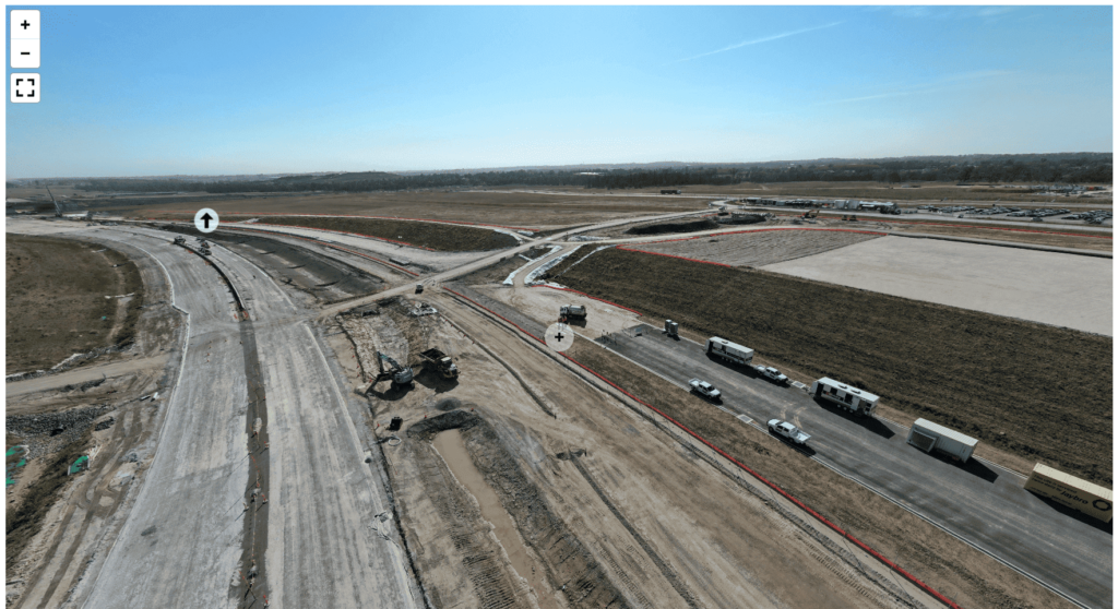
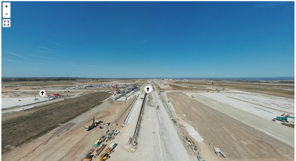
In the area of Architecture, Engineering, and Construction (AEC) industry, technological advancements continue to reshape the way we plan, execute, and plan our projects. One of innovation that has been making waves is the integration of 360 imagery capture into a construction project. As one of reality capture method, the 360 imagery captures the construction site with unparalleled insight. We can pan the image vertically or horizontally to give us more immersive experience. It also provides more opportunities for stakeholders at every stage of the construction process.
How 360 Imagery Captured?
Traditionally, capturing imagery of construction sites relied heavily on static individual photographs or limited-angle videos. We need to check the photo one by one to get a full picture of one scene. However, with 360 imagery capture, a more dynamic and immersive approach is adopted. Utilizing specialized cameras equipped with multiple lenses, images are captured simultaneously from all directions, allowing for a seamless blend of perspectives. These images can then be stitched together using advanced software algorithms to create a cohesive, interactive 360° view of the project site.
How 360 Imagery Change Construction Industry?
As reality capture methods becomes popular within the construction sector, 360 capture has emerged as a front runner. It revolutionize the way we document and visualize the projects. This innovative technology enables the creation of panoramic views and immersive 360° experiences from both images and videos, providing stakeholders with a comprehensive understanding of the project site remotely.
Remote Site Visit and Monitoring
Not all stakeholder need to be on construction site all the time. 360 imagery allows inspectors and project managers to conduct virtual site visits from the comfort of their offices, saving time and resources while ensuring thorough scrutiny of the site. We can use the 360 imagery data for project presentation or project update with any people around the world. People will get better understanding about the construction site even without going to the real location.
Quick and Easy Sharing of Data for Visualization
With 360 Image viewer, we can easily share the current project status with client and colleagues in no time. Since it is embedded in a web-based viewer, there is no additional software needed to open the data. Stakeholders can explore the project site from any angle, enabling a more comprehensive understanding of the spatial layout and design elements. This enhanced visualization capability aids in better decision-making and facilitates effective communication among project teams.
Project Documentation and Quality Control
Comprehensive documentation of the construction process is essential for project management and compliance purposes. 360 imagery serves as a detailed record of the project’s evolution, capturing key milestones, progress updates, and potential issues. By exploring the 360 image viewer, we can see defect and clash from the construction site. Therefore, we can easily communicate changes, Request for Information (RFI), and record Quality Control documentation. It is therefore, can be integrated into a current workflows in a project to enhance effective project control and management.
Enhance Collaboration
By providing stakeholders with access to a shared virtual environment, 360 imagery fosters collaboration among architects, engineers, contractors, and clients. This collaborative approach facilitates seamless coordination and alignment of project objectives, leading to enhanced efficiency and productivity.
Marketing and Stakeholder Engagement
By merging the actual construction site with the 3D design, 360 imagery enhances stakeholder engagement by offering prospective clients and investors a realistic preview of the completed project. This compelling visual representation can significantly impact decision-making and investment interest.
Future of 360 Imagery with GeoAI
As the construction industry continues to embrace technological innovation, the adoption of 360 imagery capture is inevitable. Some of current project that GeoAI manage includes:
- Weekly 360 camera drive
- Weekly LiDAR drive
- Weekly Remotely piloted aircraft system (RPAS) LiDAR
- Multiple time lapse camera
- Machine monitoring, hours of operation, off hire.
The integration of 360 imagery capture represents a significant milestone in the evolution of the construction industry. It empower stakeholders with unprecedented insights and capabilities. Combined with other type of reality capture such as LiDAR and time lapse camera, 360 imagery can shape a new era of efficiency, collaboration, and innovation in construction industry.
Category List
- 3D Point Cloud
- Artificial Intelligence
- Asset Management
- Digital Twin
- Featured
- Hardware
- Knowledge Graph
- LiDAR
- News
- Site Monitoring
- Vegetation Monitoring
- Virtual Reality
Recent Post
- As-Built Drawing Survey Sydney: LiDAR Verification for Construction Projects
- Digital Twin for Construction Projects – How LiDAR Powers Real-Time Site Models
- Road Asset Management Sydney
- Pavement Condition Survey: AI-Powered Road Assessment for Local Councils
- LiDAR Road Survey Sydney: Mobile Scanning for Councils and Transport Authorities