How UAV LiDAR Point Clouds Are Transforming Road Detection and Mapping
Road networks are the lifelines of cities and regional communities. For governments, engineers, and contractors, maintaining these networks safely and efficiently requires reliable spatial data. Traditional photogrammetry and manual surveys often miss subtle surface changes or fail to capture areas hidden under vegetation. This is where UAV LiDAR (Light Detection and Ranging) becomes a game-changer.
At GeoAI, we combine UAV LiDAR scanning with artificial intelligence to deliver precise, repeatable, and automated road detection. Our solutions provide centimeter-level insights into road condition and alignment to help asset owners make faster and data-driven decisions. We compare the UAV Lidar with other mapping methods below:
| Aspect | UAV Lidar | Drone Photogrammetry | Traditional Survey |
| Vertical accuracy | ±2–3 cm | ±5–10 cm | ±1–2 cm (point-based) |
| Vegetation penetration | Yes | No | No |
| Coverage speed | High | High | Low |
| Automation potential | High (AI-ready) | Medium | Low |
| Outputs | Point cloud, DTM, intensity map | Orthophoto, DSM | Point coordinates |
What Makes UAV LiDAR Ideal for Road Detection
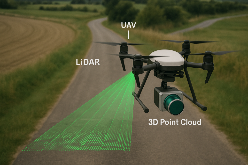
UAV-mounted LiDAR sensors emit thousands of laser pulses per second and measure their return time to generate dense three-dimensional point clouds. Each point carries not only x-y-z coordinates but also intensity values, which reveal how strongly the surface reflects the laser. The point cloud also contains color information for further analysis.
Key advantages for road applications include:
- Vegetation penetration: LiDAR pulses reach the ground through tree canopy, producing accurate ground models even in forested corridors.
- High-resolution topography: Typical UAV LiDAR systems deliver up to 400 points per m², which is enough to capture minor cracks or surface unevenness.
- Intensity-based classification: Asphalt, concrete, and gravel each return distinct reflectivity patterns, allowing AI models to differentiate road surfaces automatically.
- Large-area efficiency: UAV LiDAR covers kilometres of roadway in minutes while maintaining sub-decimetre accuracy.
- Crack detection: UAV LiDAR generates 3D point cloud data that can be used to detect crack in the road surface
Step-by-Step: Processing UAV LiDAR for Road Detection
Turning raw LiDAR data into meaningful road features involves several processing stages.
1. Pre-processing and Filtering
Noise and outliers are removed using statistical filters. Algorithms such as the Cloth Simulation Filter (CSF) or Progressive TIN Densification (PTD) separate ground points from vegetation and structures. The result is a clean Digital Terrain Model (DTM) ready for analysis.
2. Feature Extraction
From the DTM, various metrics such as slope, elevation variance, and surface roughness are calculated. Roads typically appear as flat, continuous regions with low roughness. Intensity and height variance further help isolate paved areas from natural terrain.
3. Road Segmentation and Classification
Using AI-assisted segmentation tools such as PointNet++ or U-Net (applied on rasterised LiDAR data), points are classified into categories like road surface, shoulder, curb, and vegetation. This transforms unstructured clouds into semantically labelled datasets.
4. Road Edge and Centreline Extraction
Once road points are identified, algorithms like RANSAC plane fitting or region growing are used to fit the road plane and extract precise edges and centrelines. These vectors are exported directly into GIS or CAD environments for design and inspection workflows.
5. Change Detection and Monitoring
By comparing LiDAR scans captured over different dates, this system highlights vertical displacement or deformation. Even a few centimetres of subsidence can be detected, enabling early intervention before a major failure occurs.
Real-World Applications
Road Inventory and Asset Management
Automated extraction of centrelines, widths, and surface types feeds directly into council asset registers to reduce manual time to digitalize the asset.
Construction Progress Tracking
LiDAR scans allow contractors to measure pavement thickness, verify grading, and compare as-built data against design models.
Drainage and Slope Assessment
Cross-section analysis of the LiDAR terrain model identifies low points, drainage paths, and slope angles. This data is critical for preventing flooding and erosion.
Digital Twin Integration
GeoAI integrates LiDAR-derived road models into its 3D Digital Twin Viewer, providing a live, spatially accurate environment where users can visualise, measure, and analyse infrastructure condition in real time.
How GeoAI Applies AI + LiDAR for Road Detection
GeoAI’s pipeline blends geospatial intelligence with machine learning:
- UAVs capture LiDAR point clouds of road networks and surroundings.
- Our AI models classify points into ground, pavement, vegetation, and built assets.
- The resulting data is hosted on GeoAI’s digital twin platform, enabling users to:
- Visualise cross-sections and elevation profiles
- Detect edge deterioration or rutting
- Monitor long-term deformation trends
- GeoAI delivers a unified picture of road performance and risk by combining UAV Lidar with other sensors such as mobile LiDAR, cameras, or satellite imagery.
This integrated approach supports clients across construction companies, local government, and transport infrastructure. Even though total-station surveys remain unmatched for millimetre accuracy on single sites, UAV LiDAR achieves the optimal balance between coverage, precision, and automation. This approach is ideal for large-scale infrastructure inspection.
The Future: Intelligent Road Networks
As LiDAR hardware becomes lighter and more affordable, AI-enhanced LiDAR analytics will enable continuous monitoring of entire road networks. Automatic detection of potholes, edge failures, or surface deformation from sequential scans will feed directly into maintenance schedules.
At GeoAI, this vision is already underway. Our research and field projects combine machine learning, temporal LiDAR data, and digital twin visualisation. Our goal is to create a predictive model of infrastructure health that alerts owners before visible damage occurs.
Frequently Asked Question (FAQ)
Most UAV LiDAR systems achieve 2–3 cm vertical accuracy and 3–5 cm horizontal accuracy, sufficient for design verification and deformation monitoring.
For construction projects, monthly or milestone-based scans are common. For asset monitoring, annual or post-event surveys help track long-term stability.
LiDAR primarily measures elevation, so micro-cracks below its point spacing may not be visible, but it effectively detects surface deformation and rut depth.
Processed point clouds and DTMs are imported into GeoAI’s 3D Digital Twin Viewer, where users can visualise, measure, and overlay historical data for change detection.
Category List
- 3D Point Cloud
- Artificial Intelligence
- Asset Management
- Digital Twin
- Featured
- Hardware
- Knowledge Graph
- LiDAR
- News
- Site Monitoring
- Vegetation Monitoring
- Virtual Reality
Recent Post
- Digital Twin Integration for Road Networks Using LiDAR and AI
- Pavement Crack Detection using AI and LiDAR
- Pavement Defect Detection with GeoAI: Harnessing Laser Scanners and Profilers
- Asset Inventory Mapping with GeoAI: Complete Road Asset Capture Using Laser Scanning and Profiling
- Mobile Laser Scanner and Laser Profiler: Dual Approach to Road Surface Condition Surveys