Exploring the UAV LiDAR Scanner
UAV LiDAR (Unmanned Aerial Vehicle Light Detection and Ranging) is one of reality capture method by using Laser scanner that is mounted in an aerial vehicle. It has capability to scan a large area in a short time, making this method cost effective for different application such as construction, mining, and powerline inspection.
Imagine capturing intricate details of a construction site or vast terrain in a fraction of the time and cost of traditional methods. Enter UAV Lidar, a powerful technology transforming data collection across various industries. Let’s talk about the fascinating world of UAV Lidar, exploring its characteristics, benefits, and how it’s reshaping numerous fields, with a particular focus on construction projects.
What is LiDAR technology?
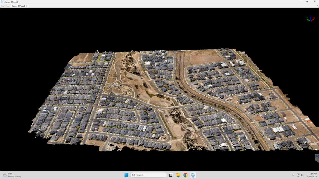
LiDAR is a technology to examine the surface of the surveyed area by emitting light pulses. The laser sends a pulses and reflected off an object, the reflected light signal hits the light sensor. The distance is calculated by taking the speed of light and halving the time it takes from sending to receiving. The emitting laser happens multiple times and so fast until we can map the surface of the area to create highly accurate 3D point clouds – digital representations of real-world objects and landscapes.
What is UAV Lidar?
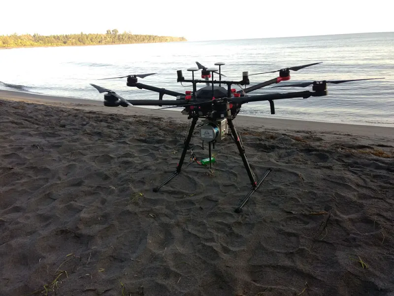
At its core, UAV Lidar, usually called as drone LiDAR or aerial LiDAR is a dynamic duo. It combines the agility and accessibility of drones (UAVs) with the precise distance measuring capabilities of Lidar technology. Mounted on a UAV, Lidar becomes a powerful tool for gathering detailed spatial data from previously inaccessible or challenging areas.
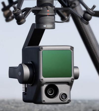
Drone LiDAR scanner usually integrated with RGB camera system, Global positioning System (GPS) and high accuracy Internal measurement Unit (IMU). As a result, it can produce an accurate 3D point cloud with global coordinate information. It has a high efficiency for up to 2 km square in a single flight and produce thousands of points per second.
The Benefit of UAV Lidar
UAV/drone Lidar boasts several characteristics that make it a game-changer:
- Unmatched Efficiency: Compared to traditional ground-based surveying methods, aerial Lidar collects data significantly faster and at a lower cost. Drones can cover vast areas in a single flight, minimizing disruption and saving valuable time.
- Unprecedented Accessibility: Tight spaces, steep slopes, or hazardous environments pose no challenge for UAV Lidar. Drones can navigate these areas with ease, capturing data that would be difficult or even dangerous to obtain on the ground.
- Highly Accurate Data: Aerial Lidar delivers highly precise 3D point clouds, providing a near-real-time representation of the surveyed area. This data accuracy is crucial for informed decision-making across various applications.
UAV Lidar Takes Flight Across Industries
The applications of aerial Lidar are as diverse as the landscapes it captures. Here are some key areas where this technology is making a significant impact:
- Construction Projects: From initial site surveys and volumetric calculations to progress monitoring and BIM (Building Information Modeling) integration, UAV Lidar streamlines construction workflows. It helps identify potential issues early on, optimize material usage, and ensure project timelines are met.
- Topography and Mapping: Aerial Lidar excels at creating accurate topographic maps and digital elevation models (DEMs) of complex terrain. This information is valuable for infrastructure planning, environmental monitoring, and disaster response efforts.
- Agriculture: Aerial Lidar provides farmers with valuable insights into crop health, field topography, and irrigation needs. This data helps optimize agricultural practices and maximize yield potential.
The Future of Flight: A World Mapped by UAV Lidar
As drone-based Lidar technology matures and costs continue to decrease, its applications are sure to expand. We can expect to see this technology playing a vital role in:
- Precision agriculture: Optimizing fertilizer and pesticide application based on detailed crop health data.
- Infrastructure inspection: Inspecting bridges, pipelines, and other infrastructure for potential damage with greater ease and efficiency.
- Environmental monitoring: Tracking deforestation, monitoring coastal erosion, and mapping wildlife habitats.
The Takeaway
Aerial LiDAR scanner is more than just a fancy drone with a laser. It’s a revolutionary data collection tool with the potential to transform numerous industries. From construction sites to vast landscapes, UAV Lidar unlocks a new level of efficiency, accessibility, and accuracy. So, the next time you see a drone soaring overhead, remember, it might just be carrying the future of data collection in its payload.
Category List
- 3D Point Cloud
- Artificial Intelligence
- Asset Management
- Digital Twin
- Featured
- Hardware
- Knowledge Graph
- LiDAR
- News
- Site Monitoring
- Vegetation Monitoring
- Virtual Reality
Recent Post
- Scan-to-BIM Workflow Explained: From LiDAR Point Cloud to BIM Model
- As-Built Drawing Survey Sydney: LiDAR Verification for Construction Projects
- Digital Twin for Construction Projects – How LiDAR Powers Real-Time Site Models
- Road Asset Management Sydney
- Pavement Condition Survey: AI-Powered Road Assessment for Local Councils