Road Management and Infrastructure Planning with Mobile Laser Scanning
As Australia’s road networks expand and age, efficient road management and infrastructure planning are becoming more critical than ever. One of the most innovative technologies driving this change is Mobile Laser Scanning (MLS)—a powerful method of using vehicle-mounted LiDAR systems to capture highly detailed and accurate road and infrastructure data, all from a moving car.
Why Mobile Laser Scanning Matters for Road Management?
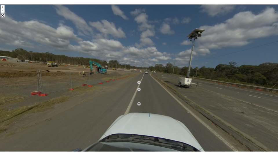
Traditional road inspection methods are often manual, time-consuming, and limited in scope. Mobile laser scanning enables fast, safe, and comprehensive data capture across extensive road networks, even in busy or hard-to-reach areas. This means that road managers and planners can make a better and faster decisions.
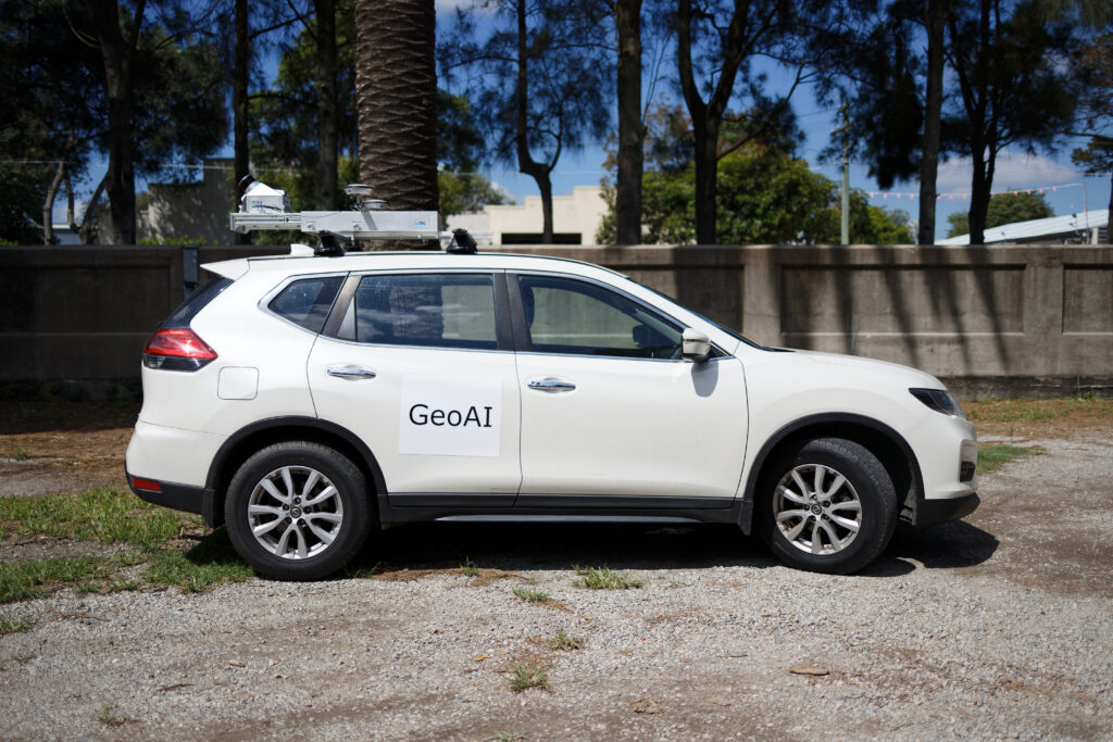
At GeoAI, we have extensive experience deploying vehicle-mounted mobile laser scanners and high-resolution cameras for road and infrastructure management projects in New South Wales. This combination allows us to capture both geometric and visual data simultaneously.
What Data Needs to Be Captured?
For effective road management, the following types of data are typically collected using mobile laser scanning:
- Road surface conditions (cracks, potholes, rutting)
- Lane widths, medians, and kerbs
- Roadside infrastructure such as signs, lighting, and barriers
- Elevation, slope, and drainage characteristics
- Vegetation encroachment
- High-precision GNSS and IMU data for accurate geo-referencing
This data forms the foundation for condition assessments, digital twins, and long-term maintenance strategies.
How GeoAI Supports Road Management with Smart Data
At GeoAI, we combine high-precision hardware, AI-driven analytics, and industry experience to deliver reliable, scalable solutions for road management and infrastructure planning. Here’s our end-to-end approach:
1. Field Data Capture
Using a vehicle-mounted LiDAR system, we scan roads in real time with minimal disruption to traffic. This allows us to capture dense 3D point clouds covering the full road corridor.
→ Learn more about our Vehicle-Mounted LiDAR for Asset Management
2. Data Processing and Analysis
Once captured, our cloud-based tools process point cloud data to extract key features, including:
- Road surface defects
- Road sign / traffic sign
- Pole identification
- Bus Stop identification
- Cross-section profiles
- Vegetation mapping and intrusion analysis
Our AI models enable automated classification, reducing processing time while increasing accuracy.
3. Information Extraction for Decision-Making
GeoAI’s data extraction tools translate complex point cloud data into:
- GIS-ready asset inventories
- CAD road geometry
- Condition scoring and reports for maintenance planning
This equips road asset owners and planners with clear, actionable insights to support daily operations and long-term planning.
→ Explore our AI-powered Vegetation Mapping that can be used in road corridor monitoring
Tools and Technologies Required
To effectively implement mobile laser scanning in road management, the following tools are essential:
- High-density LiDAR scanner with vehicle integration
- GNSS + IMU for geo-positioning
- Cloud processing platforms for large-scale point cloud data
- GeoAI software / customized Deep Learning model for AI-based object recognition and analysis
- Digital twin dashboards and export tools for integration with GIS and maintenance systems
Expected Outcomes of Automated Road Aanagement
By adopting mobile laser scanning for road networks, local councils, state departments, and infrastructure managers can expect:
✅ Rapid, high-resolution scans of entire road corridors
✅ Automated defect detection and prioritisation
✅ Up-to-date digital models for inspection and planning
✅ Enhanced worker safety
✅ Better use of budgets through predictive maintenance
✅ Fewer disruptions and faster project turnaround times
Why Choose GeoAI for your Road Management Task?
With our deep understanding of infrastructure and smart technology, GeoAI delivers integrated solutions that modernise how roads are inspected, maintained, and planned. Our team offers complete support from survey design to analytics delivery for road management and infrastructure planning need.
📞 Ready to Get Started?
Let’s future-proof your building maintenance with GeoAI.
👉 Contact us today to book a free consultation and see how our asset management system can work for your property.
📧 admin@geoai.au
🌐 geoai.au
📍 34-36 Byrnes St, Botany NSW 2019
Category List
- 3D Point Cloud
- Artificial Intelligence
- Asset Management
- Digital Twin
- Featured
- Hardware
- Knowledge Graph
- LiDAR
- News
- Site Monitoring
- Vegetation Monitoring
- Virtual Reality
Recent Post
- Pavement Crack Detection using AI and LiDAR
- Pavement Defect Detection with GeoAI: Harnessing Laser Scanners and Profilers
- Asset Inventory Mapping with GeoAI: Complete Road Asset Capture Using Laser Scanning and Profiling
- Mobile Laser Scanner and Laser Profiler: Dual Approach to Road Surface Condition Surveys
- Edge Pavement Detection: Using LiDAR and AI for Road Asset Management