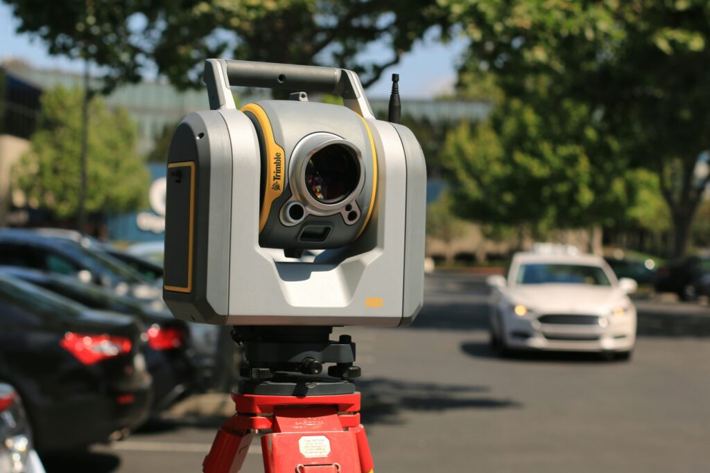
What is Terrestrial Laser Scanning?
Terrestrial Laser Scanning (TLS) is an advanced technology used to capture highly detailed, 3D measurements of objects, structures, and landscapes. By emitting laser pulses from a ground-based device, TLS creates a dense point cloud of data that represents the scanned area, offering precise, millimeter-level accuracy. This method is widely used in various industries, including construction, surveying, archaeology, and infrastructure management.
How Does Terrestrial Laser Scanning Work?
The core of TLS technology is the laser scanner, which emits rapid pulses of light that reflect off surfaces and return to the scanner. The time it takes for the laser to return is measured, providing the distance to each point on the surface. The scanner then calculates the position and angle of each reflected point to generate a detailed 3D representation, often referred to as a “point cloud.”
Once collected, these point clouds can be processed and analyzed using specialized software, allowing professionals to visualize, measure, and manipulate the data with exceptional accuracy.
Applications of Terrestrial Laser Scanning
- Construction & Engineering: TLS is frequently used in construction projects for creating accurate models of existing structures, monitoring construction progress, and conducting quality control checks. It is invaluable for ensuring that projects stay within design specifications.
- Surveying & Mapping: Traditional surveying methods can be time-consuming and labor-intensive. TLS allows for quicker data collection over large areas with greater accuracy, making it a go-to method for mapping land, infrastructure, and buildings.
- Archaeology & Heritage Preservation: TLS is used to document historical sites and artifacts in 3D. It enables archaeologists to capture detailed scans without disturbing fragile environments and assists in creating digital archives for preservation.
- Infrastructure Monitoring: Bridges, tunnels, and railways can be monitored for wear and tear using TLS. By comparing scans taken over time, engineers can detect minute changes in the structure, enabling early detection of potential issues.
Benefits of Terrestrial Laser Scanning
- High Accuracy: TLS provides precise measurements, making it suitable for projects that demand exact detail.
- Non-Invasive: The laser scanner does not require physical contact with objects, making it ideal for sensitive or hazardous environments.
- Versatility: TLS can be used across a wide range of environments, from small indoor spaces to large outdoor landscapes.
The Differences Between Terrestrial Laser Scanning (TLS) and Mobile Laser Scanning (MLS)
While Terrestrial Laser Scanning (TLS) and Mobile Laser Scanning (MLS) are both methods of capturing 3D data through laser technology, they differ in terms of operation, mobility, and application.
1. Mobility and Setup
- Terrestrial Laser Scanning (TLS): TLS involves a stationary scanner that is set up on a tripod or similar stable platform. The scanner remains fixed during data collection, meaning the operator may need to move it to multiple locations to cover a large area. This makes TLS ideal for scenarios where a high level of detail is required, but speed is not as critical.
- Mobile Laser Scanning (MLS): In contrast, MLS is mounted on a moving platform such as a vehicle, drone, or even a backpack. The scanner captures data while in motion, which allows for faster data collection over larger areas. MLS is often used for surveying long corridors, roads, or urban environments, where covering distance quickly is important.
2. Accuracy and Detail
- TLS: TLS generally provides a higher level of accuracy and detail compared to MLS. Because the scanner remains stationary and can take time to capture the scene from multiple angles, TLS is ideal for applications requiring millimeter-level precision, such as construction quality control, heritage documentation, and structural analysis.
- MLS: While MLS offers slightly less precision compared to TLS due to the movement of the scanning platform, it still provides a high level of accuracy suitable for many applications, such as road surface mapping or creating 3D city models. The trade-off is a slightly lower level of detail for the benefit of speed and broader coverage.
3. Speed and Efficiency
- TLS: Data collection with TLS can be time-consuming because it requires multiple setups at different locations to scan large or complex environments. Each scan may take several minutes, and moving the scanner to a new position adds time to the process. Therefore, TLS is best suited for smaller, detail-oriented projects or where fixed, precise measurements are critical.
- MLS: MLS excels in terms of speed. The scanner collects data continuously while moving, significantly reducing the time needed to survey large areas. This makes it ideal for projects such as road surveying, city mapping, and infrastructure monitoring, where covering large distances quickly is more important than extremely fine details.
4. Applications
- TLS: Commonly used for high-precision tasks such as building documentation, bridge inspections, and heritage conservation. It’s also used in forensic investigations where every detail matters.
- MLS: Typically employed for large-scale projects like road and highway mapping, urban planning, and outdoor environmental surveys. MLS is preferred when the primary goal is to capture a general layout rather than highly detailed measurements of small features.
Conclusion
The choice between Terrestrial Laser Scanning (TLS) and Mobile Laser Scanning (MLS) depends on the specific needs of your project. TLS is perfect for projects that require high precision and detailed data in smaller, focused areas. Meanwhile, MLS is better suited for large-scale, rapid surveys that prioritize speed and broader coverage. Both methods offer powerful solutions for 3D data collection, with their unique advantages and trade-offs. It makes them indispensable tools in fields like construction, surveying, and infrastructure management.
Understanding these differences can help you choose the right technology to fit your project’s needs.
Want to know more? Contact us to explore how terrestrial laser scanning can enhance your project today!
Category List
- 3D Point Cloud
- Artificial Intelligence
- Asset Management
- Digital Twin
- Featured
- Hardware
- Knowledge Graph
- LiDAR
- News
- Site Monitoring
- Vegetation Monitoring
- Virtual Reality
Recent Post
- Smart City Infrastructure Monitoring for Civil Engineers Using LiDAR and AI
- Digital Twin Integration for Road Networks Using LiDAR and AI
- Pavement Crack Detection using AI and LiDAR
- Pavement Defect Detection with GeoAI: Harnessing Laser Scanners and Profilers
- Asset Inventory Mapping with GeoAI: Complete Road Asset Capture Using Laser Scanning and Profiling